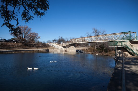
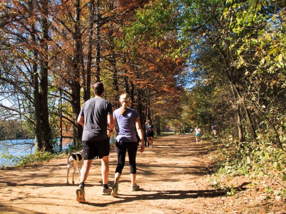
Seen on a Volkssport Walk along the Brushy Creek Regional Trail
Tag: volkssport

Down the path
Posted by miri On 10 February, 2013

Brushy Creek Regional Trail
Posted by miri On 9 February, 2013
Seen on a Volkssport Walk along the Brushy Creek Regional Trail
2/2: Cedar Park Volkssport Walk
Posted by miri On 7 February, 2013
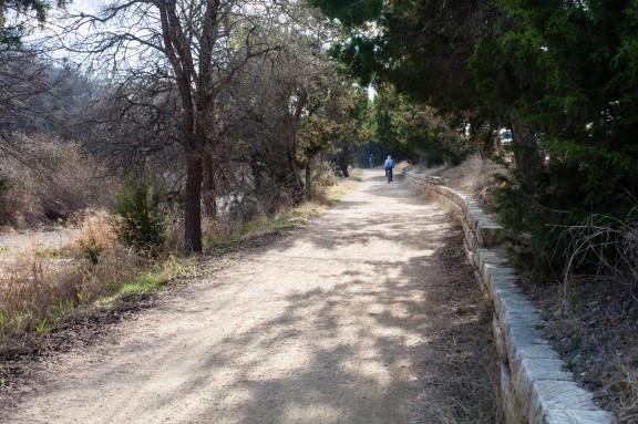
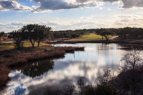
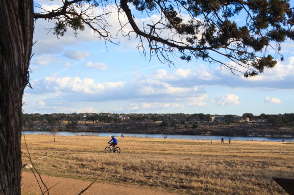
Not a lot of blogging about walks recently, huh? Let’s just say the binging urge has been stronger than the walking one lately. I really need to find a way to turn that around as I’ve gained 10 pounds and am freaking out a bit. Last Saturday, however, I did go on a rather long (but very slow) walk in Cedar Park. The Brushy Creek Trail is a wonderful place to walk. It wasn’t super crowded, alternated between paved and non and was quite pleasant. I highly recommend it!
Info from Endomondo:
Photos – on flickr or view the slideshow:
(I just took a few photos.)
1/12: One day, two walks
Posted by miri On 12 January, 2013
AustinFit Walk
This morning started with a shortened AustinFit Group walk. A lot of the group are walking a half marathon tomorrow, so needed to keep today short. Plus, some of us were going from the group walk down to San Marcos for a Volkssport walk, so we needed to keep it short too. It was supposed to be a 3 mile walk, but my GPS said it wasn’t even 2.5. Quick and easy despite the spitting rain!
Route and info:
HRM info:
Effect: Fitness and max performance improving
Calories: 226
Percent of calories fat: 25%
Average heart rate: 130
Max heart rate: 145
San Marcos Volkssport Walk
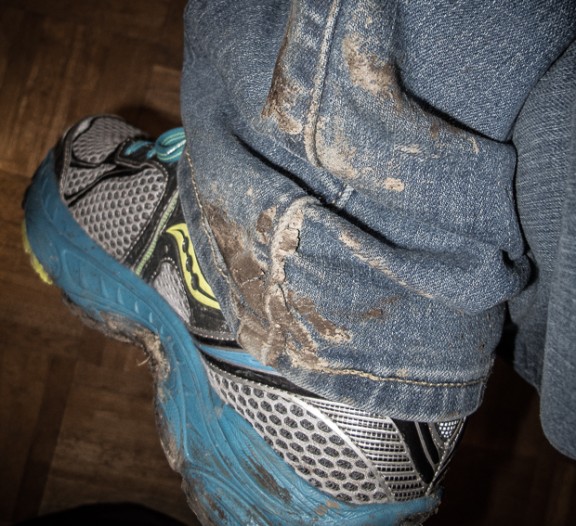
Then it was a quick drive down to San Marcos (I stopped in Buda to change clothes). The walk started at Aquarena Center. This used to be a cheesy tourist park when I was growing up, but now it’s a nature and research center (with a few touristy things to help with funding). The weather continued to be sucky (no rain, but the air felt like it was 100% water) which was a shame because the Spring Lake Natural Area is quite nice on a sunny, clear day. My walking buddy, Edwin, and I got a bit confused and ended up doing the second part of the walk first, but I liked that better. It put us in town and on the streets before traffic got to bad and it meant we ended up in the nature area – a much more peaceful end to the walk than all the construction filled streets! We were just walking, but I somehow came home with mud caked on the inside of my legs from my feet all the way up to my knees. Talent!
Route and info:
HRM info:
Effect: Fat burn improving
Calories: 339
Percent of calories fat: 46%
Average heart rate: 101
Max heart rate: 122
We are just going to skip over what I had to eat this afternoon. Let’s just say it wasn’t good – for me or my “no binge” goal.
1/6: Lampasas Volkssport walk
Posted by miri On 12 January, 2013
After the horrible AustinFit walk I had the day before, I decided I needed to get out and about in a relaxed and non goal-oriented way. Plus, I wanted to drive…someplace…fast. I love driving on the highway with music blaring while singing along at the top of my lungs. The weather was perfect, so off I went to the AVA website to find a nearby, but not too nearby walk. I looked through my options and picked Lampasas – a reasonably short drive on a highway that’s not often overly crowded. Turns out, it was the perfect decision.
The drive was just what I needed to pick up my mood. The lady in the hotel lobby where the walk box was stored was super nice. And, lastly, the walk was a good one. It was a bit odd how you keep winding around a few of the same streets, but it is a small town. There was some nice variety (big old houses, run down houses, rusty things – a favorite of mine – outdoor sculpture, springs and a cemetery) and I did mention the perfect weather, right? Next time you are in Lampasas, try the Sulfur Creek/Downtown AVA walk.
Route & Info via Endomondo:
(Including a few wrong turns…I think my dyslexia is getting worse!)
Info from HRM:
Effect: Fat burn improving
Intensity: almost all of the time in zone 1
Calories: 347
Percent fat calories: 48%
Average heart rate: 97
Maximum heart rate: 122
Photos:
Photos can be found here or watch the slide show:

Vines
Posted by miri On 9 January, 2013

Falls
Posted by miri On 8 January, 2013

Autum
Posted by miri On 19 December, 2012
12/2: Fairview Park Volkssport Walk
Posted by miri On 2 December, 2012
A slightly overcast day wasn’t going to stop me from walking. I decided to do the Colorado River Walker‘s annual Fairview Park walk. It starts from the same hotel as the Lady Bird Lake one and winds around some lovely neighborhoods in South Austin – complete with some fantastic looking homes – and ends up going down the SoCo shopping strip. Yes, I went shopping! And stopped at the trailer food park. I can haz Smorkin’ Labbits from Monkey See? And a pumpkin cupcake from Hey, Cupcake! And a slice of Margherita pizza from Home Slice? Oh, what a wonderful day.
Route:
Info as reported by Endomodo:
Distance 7.58 mi (I think it was just 6.2 miles)
Duration 3h:59m:18s
Avg. Speed 1.9 mph
Max. Speed 5.4 mph
Calories 815 kcal
Hydration 1.72L
Min. Altitude 406 ft
Max. Altitude 589 ft
Total Ascent 1191 ft
Total Descent 1130 ft
Photos:
Can be found here.
11/26: Lady Bird Lake Volkssport Walk
Posted by miri On 26 November, 2012
The only thing that could have made today’s walk more perfect was if I’d taken my big camera with. As it was, I decided to take my point and shoot since I was carrying a picnic lunch. Big mistake – the weather and scenery were wonderful.
I did the Lady Bird Lake annual Volkssport Walk (run by the Colorado River Walkers). The walk starts at a hotel just off Riverside and winds around Lady Bird Lake and Barton Springs. It was a lovely fall afternoon – if a big windy. The parks were full of people relaxing and/or trying to work off their Thanksgiving dinner from the previous Thursday. It was one of those, “why the heck don’t I come down here and enjoy this more often” kind of things. I mean, seriously – it’s so lovely here I should come down and walk around the lake all the darn time.
Overheard:
Mom to tot in stroller: Isn’t it nice out? And no mosquitoes biting us.
Tot: Why not? Were are they? On vacation?
Mom: *chuckling* Yes, sweetie, they are on vacation.
Photos are here or watch this slide show:
Route:
Info per Endomondo:
Distance 8.65 mi – more like 6.5
Duration 3h:58m:59s
Avg. Speed 2.2 mph
Max. Speed 25.8 mph – hahahaha! Man, the GPS on my phone sucks
Calories 874 kcal
Hydration 0.94L
Min. Altitude 340 ft
Max. Altitude 500 ft
Total Ascent 525 ft
Total Descent 532 ft
